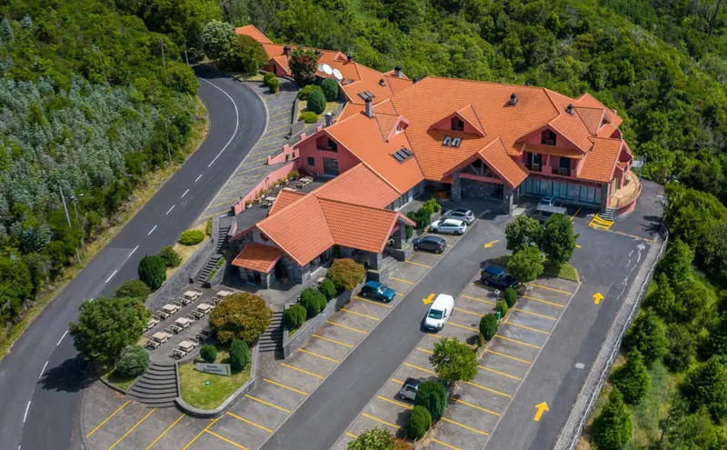
Encumeada Viewpoint
Mountain scenery and deep valleys almost on the hotel’s doorstep.
Use the map to see what surrounds Valley View and discover trails, viewpoints, towns and some of Madeira’s most iconic places.
Encumeada makes it easier to combine mountains, forest, the north coast and the south coast during the same stay. Use the map to understand where the hotel sits in relation to key places around Madeira.
Filter places by type, select a marker and open the location directly in Google Maps. Driving times always depend on traffic, weather and road conditions.
Indicative map. Locations and access conditions may change; always check local conditions before setting out.
A selection showing the variety you can combine from Encumeada.
Mountain scenery and deep valleys almost on the hotel’s doorstep.
A north-coast village surrounded by mountains, forest and the Atlantic.
A south-coast town linking the valley naturally with the sea.
Madeira’s high plateau, gateway to landscapes, levadas and Rabaçal.
One of the island’s best-known walking areas, with several levadas and waterfalls.
Madeira’s capital, with historic streets, gardens, markets and waterfront.
A characterful fishing village between the sea and the south-coast hills.
One of Madeira’s best-known viewpoints above the dramatic south-coast cliffs.
North-west coast, volcanic natural pools and Atlantic scenery.
Access to all classified walking trails (PR) in Madeira requires a timed reservation before starting the hike, through the official SIMplifica portal. This applies to individual visitors, groups and guided walks.
Book before you leave and check the trail status again on the day. Conditions can change because of weather, maintenance or safety.
Continue exploring recommended routes and see their start and finish points on the map.
One of the routes most closely connected to Encumeada, combining levadas, Laurissilva forest and mountain scenery.
A historic path ending in Encumeada. Some sections may be restricted — always check the official status.
One of Madeira’s best-known levadas, in Rabaçal, returning along the same route.
The most direct way to reach Madeira’s highest point, starting at Achada do Teixeira.
A long levada through Laurissilva forest, with tunnels and the Caldeirão Verde scenery.
A linear route between Ribeiro Frio and Portela. Plan transport between the finish and starting point in advance.
Volcanic coastal scenery that feels completely different from the green interior of the island.
Orientation map. Select a trail to highlight its start (A) and finish (B). On-site signage and official IFCN / Visit Madeira information always take precedence.
Always check the official status of trails and roads on the day. Mountain weather and maintenance work can change access quickly.